Rail Transportation Projects - Los Angeles County Metro
Subway and Light Rail transportation became a reality for Los Angeles in the mid 1980s. These two projects marked the beginning of our firm's participation with Los Angeles County Metro rail system projects.
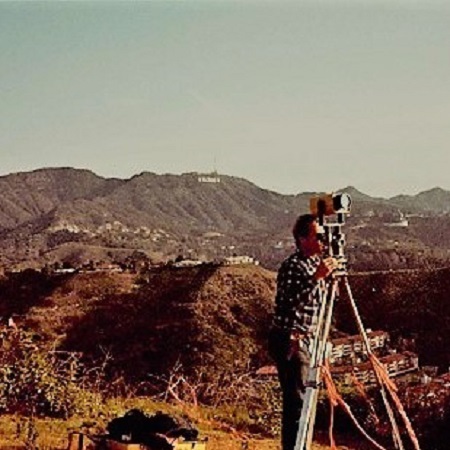
Red Line Expansion from Downtown to Universal City
- Subway Tunneling Project
- Design and Right-of-Way Mapping
- As-built Surveys in underground sewers and storm drains
- GPS Surveys for control and geo-technical soil boring locations to facilitate tunneling work in the Hollywood Hills.
|
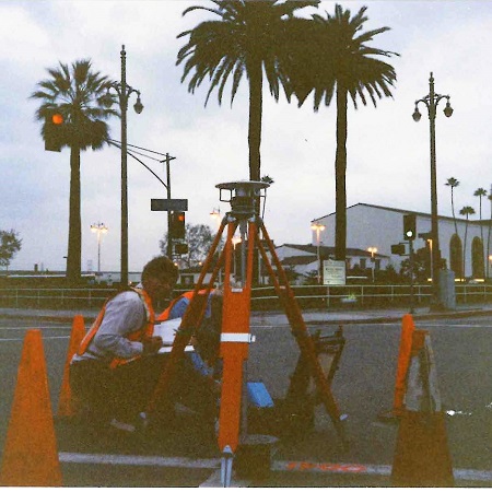
Blue Line Expansion from Downtown to Pasadena
- 14-Mile Light Rail Project
- Photogrammetric Control Surveys
- Horizontal and Vertical Controls (GPS & Electronic Leveling)
- Surveys: design data acquisition, mapping & cadastral, topographic, x-sections.
|
|
Back to Top
|
|
|
|
|
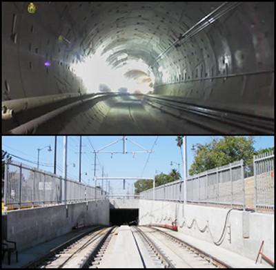
GOLD LINE EASTSIDE EXTENSION & TUNNEL
Client: Carter-Burgess / Los Angeles County Metro
Our firm provided field and office support to the construction manager of this 1.2 mile, light rail tunneling project, which is part of the Los Angeles County Metro Light Rail Transit system. Our firm performed the following specific services:
- Topographic Surveys
- Horizontal & Vertical Control Verifications
- Tunnel Construction Alignment & Surface Deformation Monitoring
- Tunnel Alignment & Concentricity Monitoring
- Calculation and Mapping Functions
- Daily Monitoring and Subsidence Reports - reduced, adjusted, compiled & prepared
|
 |
|
Back to Top
|
|
|
|
|
|
CRENSHAW/LAX EXTENSION
Client: Geocomp/Walsh Shea Corridor Constructors JV / Los Angeles County Metro
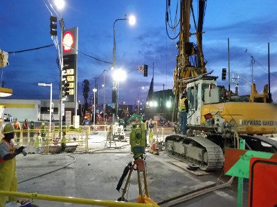
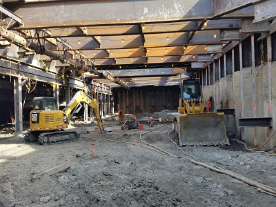
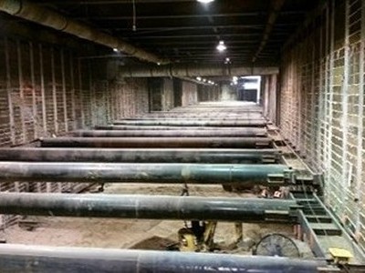
Cabrinha, Hearn & Associates provides survey support for geotechnical monitoring on this tunneling project. The Crenshaw/LAX Transit Project is part of the expansion projects within the Metro Rail system in Los Angeles County, which will expand Los Angeles County's existing light rail infrasture. Our firm supports the construction of this vital transportation project by providing the following services:
- Establish Survey Controls for Structure Monitoring in Excavation Tunneling Sites
- Set Building, Surface and Excavation Monitoring Points Prior to Construction.
- Conduct Daily Deformation Monitoring During Construction.
|
Geotechnical Monitoring
|
Station Excavation
 |
Station Box Monitoring
|
|
Back to Top
|
|
|
|
|
|
PURPLE LINE EXTENSION, SECTION 1
Client: Westside Extension Support Team JV/Los Angeles County Metro
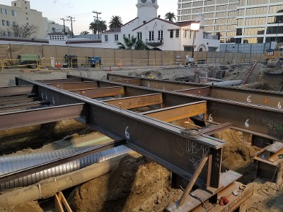
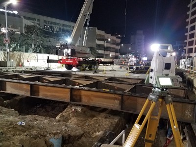
Our firm provides surveying services for Construction Managment Support Services in this 3-mile tunneling project. The Purple Line Westside Extension, Section 1 is part of the Los Angeles County Metro Subway system expansion projects, which will connect commuters between downtown Los Angeles and Westwood. Our firm provides:
- Horizontal and Vertical Control Verification and Densification Surveys
- Exploratory Shaft Site Monitoring
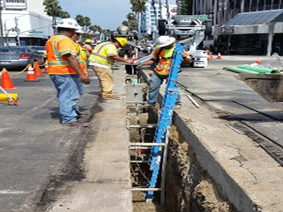
- As-built and Topographic Surveys and Mapping using Advanced Utility Relocation (AUR)
- Utility Plan Verifications
- Monument Preservation and Restoration
|
Subway Station Construction
|
AUR Surveys
|
Night Shift Surveying
|
|
Back to Top
|
|
|
|
|
|
CALIFORNIA STATE UNIVERSITIES
Client: Wheeler & Gray Consulting Engineers / California State University
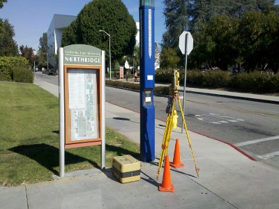
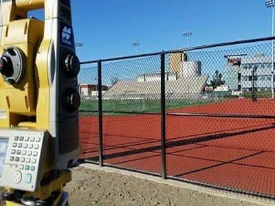
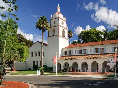
Cabrinha, Hearn & Associates has provided various land surveying services on numerous campuses over the past 20 years. We have worked as a subcontractor to Wheeler & Gray, and have also worked directly with California State Universities. Projects have included accessibility improvements; campus beautification/modernization; construction of multi-story parking structures, educational facilities, and housing; parking lots; and athletic fields. Our firm has provided a variety of services, such as:
- Detailed Design Topographic Surveys
- ALTA
- Construction Layout Staking
- Aerial Mapping
- Preparation of Easements and Legal Descriptions
|
Cal State San Bernardino

|
Cal State Northridge
|
Cal State Los Angeles
|
CSUSB Palm Desert Campus
 |
CSU Maritime Academy
 |
CSU Channel Islands
|
|
Back to Top
|
|
|
|
|
|
|
LOS ANGELES COMMUNITY COLLEGES
Client: Harper Construction Company, Inc. / Los Angeles Community College District
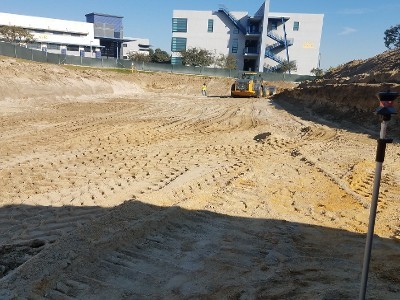
Cabrinha, Hearn & Associates provides land surveying services at several community colleges within the Los Angeles Community College District. Our firm has worked on a variety of construction projects consisting of multi-story education buildings and parking structures. Some of the services our firm provides on these endeavors are:
- Construction Layout Surveys
- Anchor Bolt Verifications
- Rough Grading
- Fine Grading
- Site Utility Staking
- As-built Surveys
|
Los Angeles Community College

|
Los Angeles Southwest College
|
East Los Angeles College

|
|
Back to Top
|
|
|
|
|
|
SANTA MONICA ON-CALL SURVEYING
Client: City of Santa Monica
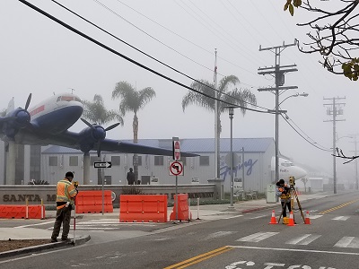
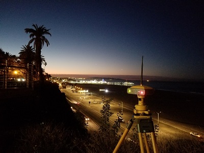
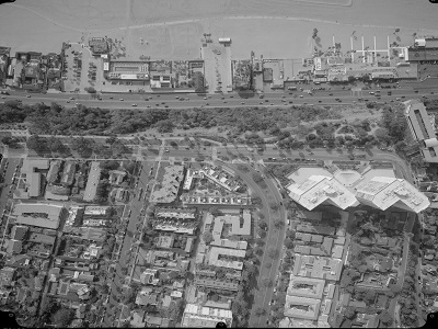
As part of a multi-year, on-call contract, our firm provides the City of Santa Monica with a variety of land surveying services using ground, aerial and GPS surveying equipment to meet our client's needs on a various exciting projects.
|
Design Surveys
|
GPS Control Survey
|
Aerial Mapping
|
|
Back to Top
|
|
|
|
|
|
I-605 HOT SPOTS
Client: Michael Baker International/Los Angeles County Metro
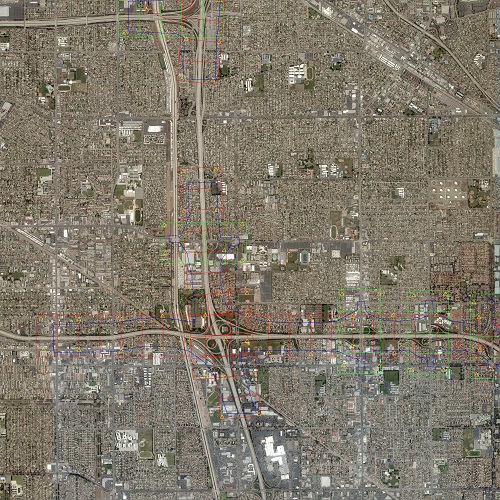
Our firm provided aerial mapping and control surveys for the 605 Interstate Highway "Hot Spots." This project is part of the Los Angeles County Metro's I-605 Corridor "Hot Spots" Program designed to reduce congestion along the heavily traveled 605 Interstate Highway in Los Angeles County. Specific services provided to our client included:
- Prepared Control Surveys Reduction and Post-Processing were completed utilizing Starnet and Topcon Magnet software.
- Mapped 16 miles of the Interstate at 50 scale with 2’ CI.
- Established primary and secondary controls for aerial mapping and future design surveys
- Utilized airborne GPS & static GPS digital bar code leveling TS surveys for control establishment.
- Prepared Caltrans DOP Item A, B and C for approval.
- Performed all work per Caltrans guidelines, with LA County Metro and Caltrans oversight.
|
 |
|
Back to Top
|
|
|
|
|
CALTRANS ON-CALL SURVEYS
Client: Caltrans
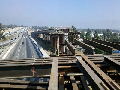
Our firm was involved in both Design and Construction Phases on this 2,000 linear foot, three-lane bridge structure spanning the Interstate 5, Interstate 170 and the Tujunga Wash. Our firm provided complete construction staking for the Northbound flyover. Specific tasks performed by our firm were:
- Survey Calculations
- Staking
- Pre-Pour Form As-builts
- Mapping
- Property Line Staking
- Property Line Location
- Construction Staking
- Staff Augmentation
|
 |
|
Back to Top
|
|
|
|
|
CITY OF PASADENA ON-CALL SURVEYS
Client: City of Pasadena
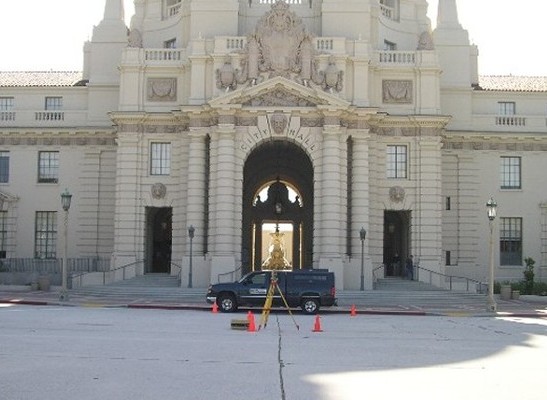
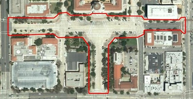
During this multi-year, ongoing contract, our firm provided an array of as-needed surveys for the City of Pasadena. Our firm completed all tasks on-time and on budget. Surveying cateogories included:
- Monument Preservation
- Design Surveys
- X-Section Surveys
- Topographic Design Street Cross-Sections
- Utility Location
- Right-of-Way Mapping
- Construction Staking
- Aerial Mapping
- Preparation of Legal Descriptions
|
Civic Center Design
|
Civic Center Design Survey
|
|
Back to Top
|
|
|
|
|
PASADENA ROSE BOWL RENOVATION
Client: Clark Construction
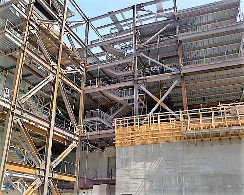
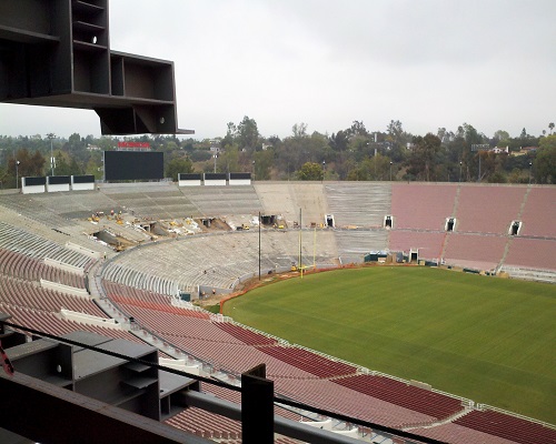
Our firm was an integral part of the design and construction teams on the expansion and renovation project at the historic Pasadena Rose Bowl. Work consisted of complete renovation to the interior and exterior of the stadium; updates to all tunnel structures; demolition and construction of the Rose Bowl Press Box consisting of press facilities, private suites, security command center, and facilities to support these services. Our firm provided construction staking and regular monitoring to ensure structural integrity at this historic Pasadena icon.
|
Rose Bowl Structure Construction
|
Rose Bowl Modernization
|
Rose Bowl Renovation

|
|
Back to Top
|
|
|
|
|
|
PASADENA CONVENTION CENTER
Client: Clark Construction
The Pasadena Convention Center Renovation and Expansion Project consisted of renovations to the interior and exterior of the Conference Center, complete demolition of the Exhibit Hall and West Plaza, and construction of a new 60,000 square foot exhibition hall, a 25,000 square foot ballroom, and 28 new conference breakout rooms, and a 29,000 square foot stressed membrane structure. Our firm provided construction staking and structure monitoring in the pre-construction and construction phases of this project.
|
|
|
|
FAIRMONT AVENUE EXTENSION
Client: Jacobs Engineering
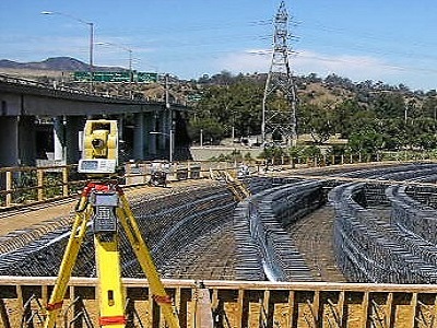
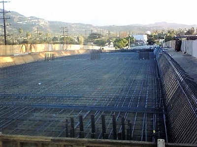
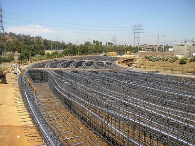
Fairmont Avenue Extension Project included construction of a bridge structure on Fairmont Avenue, which extended the road to the west over San Fernando Road, the Los Angeles County Metro's railroad tracks, and the Verdugo Wash. Cabrinha, Hearn & Associates provided field and office construction management support on the flyover and new roadway construction portion of this project. Services our firm provided on this infrastructure project included:
- Topographic, As-built, Horizontal, and Vertical Control Check Surveys
- Calculations
- Ground Mapping
- As-built Surveys of Soffits and Dowels.
|
Horizontal Check Survey
|
Form/Dowel Verifications
|
Roadway Construction
|
|
Back to Top
|
|
|
|
|
|
WONDER VALLEY SOLAR DALE DRY LAKE
Client: Parsons
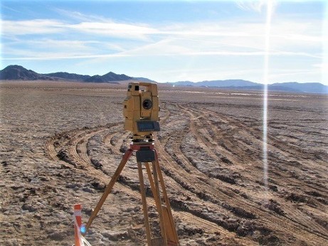
Cabrinha, Hearn & Associates completed topographic mapping of a 3,200 acre site for construction of a proposed utility facility, in addition to the following services:
- Located all existing on-site utilities
- Recovered existing horizontal and vertical controls
- Recovered section and township Lines
- Established permanent on-site control monumentation
- Mapped 3,200 acres
|
|
|
Back to Top
|
|
|
|
|
FORT IRWIN WASTE WATER TREATMENT FACILITY
FORT IRWIN GOLDSTONE APOLLO DEEP SPACE ANTENNA SITE
Client: CDM Smith / CH2M Hill
Our firm performed a variety of surveying services on these projects located within the United States Military Fort Irwin National Training Center. We provided the following services:
- Prepared Topographic Design Mapping
- Established Horizontal and Vertical Control Monuments
- Located On-Site Utilities
- Tied utility locations to existing Fr. Irwin DIS Utility Mapping
- Located geotechnical boring locations
- Construction Staking
|
|
|
|
Residential Surveys
Since 1976, our firm has been serving residential clients in the Southern California area. If you are considering purchasing a property, a survey is recommended to ensure the property boundaries coincide with the title report you may have received. A survey is usually required by local and state ordinances for new construction, construction improvements to an existing structure, or subdivision of a parcel of land. Our team of experts will conduct the particular survey needed and prepare accurate and precise reports quickly.
|
Image Coming Soon!
Boundary/Property Line Location
Our land surveyor will take accurate measurements of your proprety, complete a survey report, and file all appropriate documentation with the County Registrar
|
Image Coming Soon!
Architectural Site Survey
|
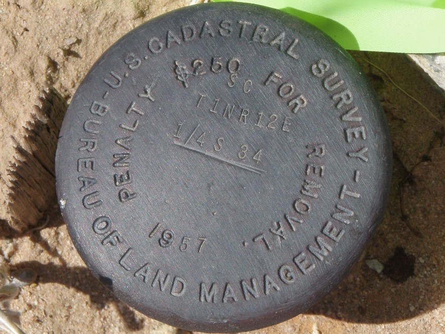 Corner Replacement Corner Replacement
|
|
Back to Top
|
|
|
|
|
|
|